FishTrek 98
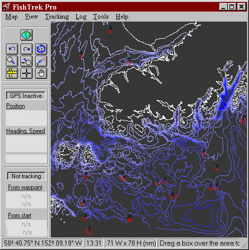
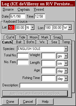
Nautical charts are fine for navigation, but when it comes to fishing Scientific Fishery Systems has taken it a step beyond with the latest in bottom mapping software. In contrast to standard raster charting packages, the vector based Fishtrek 98 system integrates detailed bathymetric maps, GPS interface and automated catch logging and mapping features into one comprehensive fisheries mapping package.
Coverage Areas
|
Alaska |
West Coast |
East Coast |
|
|
Southeast (Off Shore) |
Washington |
Maine-New York City |
|
|
Prince William Sound |
Oregon |
Gloucester, Mass – Ocean City, MA |
|
|
Cook Inlet |
California |
New York-Cape Hatteras, NC |
|
|
Kodiak Island |
Ocean City, MA– Cape Fear, NC |
||
|
Bering Sea |
Cape Hatteras – Brunswick GA |
||
|
Cape Fear, NC – Melbourne, FL |
|||
|
Brunswick GA – Key Largo, FL |
|||
|
Key Largo – St. Petersburg FL |
|||
System Requirements